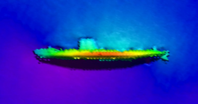
Shipwreck GOSFORD imaged with multibeam sonar
Welcome. This database of shipwrecks and underwater obstructions has been compiled from bathymetric data provided by the National Geophysical Data Center and other hydrographic agencies. The database is by no means complete and is a continuous work in progress. Check back often or follow me on Facebook.
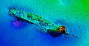
Navigate the map by panning and zooming. Click on individual pins to see a detailed listing of each site. To view the sonar images be sure to click on the Gallery tabs. You can limit the scope of pins shown on the map by using the Filter Records menu option.
![]() All GPS coordinates have been derived directly from multibeam bathymetry and are believed to be accurate, however they cannot be guaranteed. All data is provided for informational purposes only. Not for navigation.
All GPS coordinates have been derived directly from multibeam bathymetry and are believed to be accurate, however they cannot be guaranteed. All data is provided for informational purposes only. Not for navigation.
Legend
 Shipwreck
 Artificial Wreck
 Aircraft Wreck
 Natural Reef
 Artificial Reef
 Rock
Rock
 Rock Pile
 Obstruction